Showing 34 items matching buchan river
-
![Waterfall Scene Near the Buchan River / [by] Nicholas Caire, circa 1876](https://victoriancollections.net.au/media/collectors/550653872162f11fb04854aa/items/57825da5d0cdd1176ce3ed3d/item-media/57825e03d0cdd1176ce418cf/item-fit-380x285.jpg) Kew Historical Society Inc
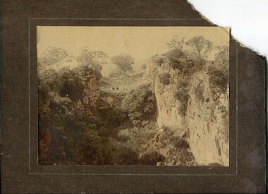
Kew Historical Society IncPhotograph, Anglo-Australasian Photographic Company, Waterfall Scene Near the Buchan River, c. 1876
... Waterfall Scene Near the Buchan River...buchan river...‘Waterfall scene near the Buchan River’ : Views of Victoria...On Reverse: ‘The Buchan River is a tributary of the great... Photograph Photograph Waterfall Scene Near the Buchan River ...Nicholas Caire was born on Guernsey in the Channel Islands in 1837. He arrived in Adelaide with his parents in about 1860. In 1867, following photographic journeys in Gippsland, he opened a studio in Adelaide. From 1870 to 1876 he lived and worked in Talbot in Central Victoria. In 1876 he purchased T. F. Chuck's studios in the Royal Arcade Melbourne. In 1885, following the introduction of dry plate photography, he began a series of landscape series, which were commercially successful. As a photographer, he travelled extensively through Victoria, photographing places few of his contemporaries had previously seen. He died in 1918. Reference: Jack Cato, 'Caire, Nicholas John (1837–1918)', Australian Dictionary of Biography.An original, rare photograph from the series 'Views of Victoria: General Series' by the photographer, Nicholas Caire (1837-1918). The series of 60 photographs that comprise the series was issued c. 1876 and reinforced a neo-Romantic view of the Australian landscape to which a growing nationalist movement would respond. Nicholas Caire was active as a photographer in Australia from 1858 until his death in 1918. His vision of the Australian bush and pioneer life had a counterpart in the works of Henry Lawson and other nationalist poets, authors and painters.‘Waterfall scene near the Buchan River’ : Views of Victoria (General Series), No.39 : Albumen silver photograph | Photo on card with Title and Description on reverse | Mounted 24 x 30 cm; Photo 12 x 17 cm.On Reverse: ‘The Buchan River is a tributary of the great Snowy River, which extends itself from Port Ricardo, on the Gipps Land coast, to considerably beyond Mt. Kosciusko, in New South Wales. It is comparatively but a stream, but, like most of the smaller rivers in Victoria, it contains some beautiful scenery, peculiar to itself. Our present illustration is characteristic of its scenery, and is taken from a creek close to the River.’nicholas caire (1837-1918), buchan river, landscape photography - victoria -
 Orbost & District Historical Society
black and white photograph, 1900
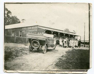
... buchan-river-view-hotel...This photograph was taken in 1900 at Buchan. The River View... at Buchan. The River View Hotel was established in Buchan in 1884 ...This photograph was taken in 1900 at Buchan. The River View Hotel was established in Buchan in 1884 and was possibly first called the Cricket Club Hotel. The isgn at the front of the building suggests that a ? Cameron ran the establishment.This an early pictorial record of Buchan in the 1900s.A small black / white photograph of a group of people standing outside a hotel A motor vehicle is in the foreground and another behind the people. On the right side of the wooden building is a sign indicating that this is River View House an accommodation business. At the front is a sign with the name ?. Cameron on it.on front - "Buchan Caves - 1900" on back - "E.A. Paige"buchan-river-view-hotel -
 Orbost & District Historical Society
letter book, James Yeates & Sons (Printing) Pty Ltd, 1977
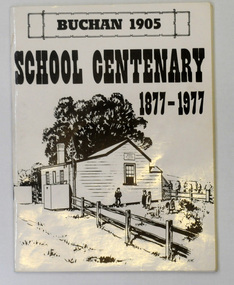
... the bridge over the Buchan River. This original school building must..., on the Orbost Rd, ⅓ of a mile from the bridge over the Buchan River ...This book was prepared for the Buchan School centenary. In the Buchan District itinerant teaching was conducted in buildings with log walls and a bark roof typical of the mid 19th century. Not until 1878 was the first State school built on the same general site as the present school, on the Orbost Rd, ⅓ of a mile from the bridge over the Buchan River. This original school building must have been constructed from high quality timber, because it still serves as the shelter pavilion. On 11th of July 1878 William Scott opened the first school of approximately 40 pupils ranging from Grade 1 - 8. A larger weatherboard school was erected in 1914. A residence was provided for the HT in 1934 and in 1956 a second classroom erected and attached to the 1914 building. Unfortunately, all records of the Committee were lost in a fire when the homestead of Alex Cameron, then serving as Committee Secretary, was burnt to the ground, but it is well known to local citizens that Frank Moon, local prospector, explorer and discoverer of the famous Buchan Limestone Caves, attended school at SS1905 Buchan. (ref SCHOOLS EAST GIPPSLAND - John Phillips)This book is a useful research tool on the history of Buchan.Two copies of a 273 pp paper covered booklet. The cover is white with the title in black print. On the front is a sketch of an old school building. On the back is a black/white photograph of children running downhill. A book on the history of the Buchan school no.1905. Includes photographs, maps and lists of school students and staff.book buchan-history buchan-school -
 Orbost & District Historical Society
album, Orbost Visitor Information Centre, 1997
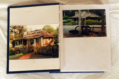
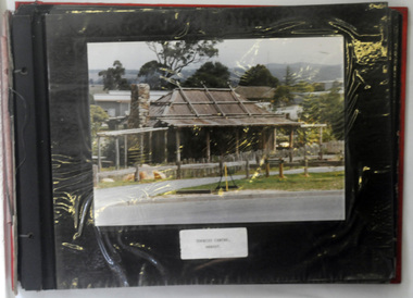
... of the Buchan and Snowy Rivers about 40 kms from Orbost on the Yalmy Rd... from the junction of the Buchan and Snowy Rivers about 40 kms ...The original slab hut was built in 1872 as a family dwelling on a site about 3 km upstream from the junction of the Buchan and Snowy Rivers about 40 kms from Orbost on the Yalmy Rd. No nails were used in the construction; it was all wired together. After a period in storage the Slab Ht was opened in its present location in Orbost as the Information Centre in 1987. This album documents an important event in Orbost.A photo album with a navy blue cardboard cover with gold embossing on the front and spine. It contains 32 photos of the 1997 10 year anniversary celebration of the establishment of the Slab Hut - the Orbost Visitor Information Centre. It also contains 3 postcards and 2 fridge magnets.slab-hut album orbost -
 Orbost & District Historical Society
box of documents, 1980s - 1990s
... three kilometres upstream from the junction of the Buchan... upstream from the junction of the Buchan and Snowy Rivers ...These documents were used at the Slab Hut (Orbost Information Centre) from 1985 - 1992 to record l visitor numbers, employment, activities, events and incorporation details. The Orbost Visitor Information Centre is situated in Forest Park on Nicholson Street. The centre is housed in the historic Slab Hut. The hut was an original family dwelling built in 1872, on a site approximately three kilometres upstream from the junction of the Buchan and Snowy Rivers.These documents record the history of tourism in the Orbost district.A cardboard storage box of documents and records of the Orbost & District Tourist Association / Slab Hut. It includes minute books, visitor numbers, details of volunteers, correspondence and details of activitiess and events.tourism-orbost slab-hut-orbost -
 Orbost & District Historical Society
album, 1990's?
... of the Buchan and Snowy Rivers about 40 kms from Orbost on the Yalmy Rd... on a site about 3 km upstream from the junction of the Buchan ...This album was used at the Orbost Visitor Information Centre (the Slab Hut). The Slab Hut (Orbost Visitor Information Centre) is an Orbost icon. This slab hut was built in 1872 as a family dwelling on a site about 3 km upstream from the junction of the Buchan and Snowy Rivers about 40 kms from Orbost on the Yalmy Rd. No nails were used in the construction; it was all wired together. After a period in storage the slab hut was opened in its present location in Orbost as the Information Centre in 1987.This item is a useful reference tool for the history of Orbost.A large photo album containing copies of photographs, some historical articles and b/w photos of Orbost. The covers are brown with a narrow gold frame. it has no spine and the covers are tied with tape. The pages, all different sizes, are bolted in.orbost-history album-photographs -
 Orbost & District Historical Society
albums, late 1980's
... the junction of the Buchan and Snowy Rivers. No nails were used... the junction of the Buchan and Snowy Rivers. No nails were used ...These two albums were used at the Slab Hut - Orbost Visitor Information Centre. The Orbost Visitor Information Centre is situated in Forest Park on Nicholson Street. The centre is housed in the historic Slab Hut. The hut was an original family dwelling built in 1872, on a site approximately three kilometres upstream from the junction of the Buchan and Snowy Rivers. No nails were used in the construction; it was all wired together. After a period in storage the slab hut was opened in its present location in Orbost as the Information Centre in 1987.These albums are contemporary records of the construction and relocation of an iconic Orbost building, the Slab Hut.Two large photo albums. 2280.1 has no front cover. The back cover and spine are red. The pages are black and most photos are labelled. They are photographs of the Orbost area. 2280.2 has brown covers. It contains photographs of the construction of the gardens and buildings around the Slab Hut (Orbost Visitor Information Centre). On the cover in gold print is "PHOTOS".slab-hut-orbost album-photographs-orbost -
 Orbost & District Historical Society
newspaper clippings, April, May 1987
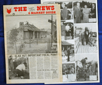
... the junction of the Buchan and Snowy Rivers. The Hut was removed from... and the Snowy River Mail. All relate to the opening of the Slab Hut ...The Slab Hut (Orbost Visitor Information Centre) was opened on March 28, 1987. It was officially opened by Dr D. Caughey, the governor of Victoria. The Orbost Visitor Information Centre is situated in Forest Park on Nicholson Street. The centre is housed in the historic Slab Hut. The hut was an original family dwelling built in 1872, on a site approximately three kilometres upstream from the junction of the Buchan and Snowy Rivers. The Hut was removed from its original site around 1970, and stored until 1984 when the Shire Council approved the current site. It was restored and brought to life as a Tourist Information Centre in 1987.The Slab Hut is an icon of Orbost. These newspaper articles are contemporary records of the opening of this building.A selection of articles from The News and the Snowy River Mail. All relate to the opening of the Slab Hut, the Orbost Visitor Information Centre. They are photographs, information and the history of the Slab Hut.slab-hut-orbost newspaper-snowy-river-mail -
 Orbost & District Historical Society
postcard series, 1960s
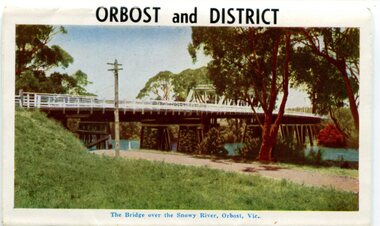
Included are photographs of the Orbost township, the Snowy River at Marlo, Gypsy Point, Buchan Caves and Bairnsdale. In the 1960s Orbost had a population of 4000 and was a major tourist attraction in Eastern Victoria with sufficient accommodation and facilities. It was the major town close to several national parks with access to either the surf or the snow. These postcards are pictorial records of Orbost in the 1960s. Postcards are very interesting records of places. architecture and transport.A colour postcard series with photographs of Orbost and the district. The cover photograph is of the Snowy River Bridge. There is an information card.Each photograph is labelled. at the bottom.postcards-orbost postcards-east-gippsland -
 Orbost & District Historical Society
black and white photograph, Segerberg & Bulmer, late 19th century
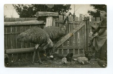
Charles Henry [Carl] Grove died on 17/4/1938 at Box Hill at the age of 88 and was buried in Orbost. Prior to coming to the Snowy River district, Carl worked as overseer on Buchan Station. In 1880, he selected land at Newmerella after first coming here in 1874 with early selector James A Robertson. He married Annie Robertson in 1876. Carl was a farmer, hop and seed grower and nurseryman. He was an elected Councillor of the newly formed Tambo Shire in 1882, and then in 1892 to the Orbost Shire where he served for many years filling various public roles. In 1911, he shifted to Queensland, but later returned to Victoria and died at Box Hill. (info. Newsletter 113)Two black / white photographs of a woman in a pen feeding two emus and some chickens.grove-annie grove-carl -
 Orbost & District Historical Society
black and white photograph, late 19th century - early 20th century
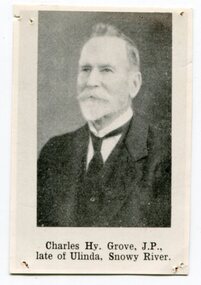
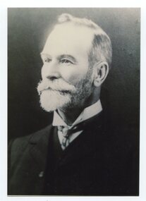
This is a photograph of Councillor Charles Henry Grove who represented South Riding on the Orbost Shire Council. from 1893 - 1901. He was president in 1893-1894, 1895-1896 and 1900-1901. He also served on the Tambo Shire prior to the formation of the Croajingolong / Orbost Shire. Charles Henry [Carl] Grove died on 17/4/1938 at Box Hill at the age of 88 and was buried in Orbost. Prior to coming to the Snowy River district, Carl worked as overseer on Buchan Station. In 1880, he selected land at Newmerella after first coming here in 1874 with early selector James A Robertson. He married Annie Robertson in 1876. Carl was a farmer, hop and seed grower and nurseryman. He was an elected Councillor of the newly formed Tambo Shire in 1882, and then in 1892 to the Orbost Shire where he served for many years filling various public roles. In 1911, he shifted to Queensland, but later returned to Victoria and died at Box Hill. (info. Newsletter 113)This item is associated with Carl Grove, a prominent early Orbost citizen.A small black / whitee head and shoulders photograph of a man with beard and moustache, He is wearing a suit and tie.grove-charles -
 Orbost & District Historical Society
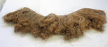
grass skirt, approx. 1905
Worn by Mrs Jack Mundy while in New Hebrides. The Mundy family were farmers / settlers in the Snowy River area since c. 1880s. The original Mundy family moved to a land "selection" at Bete Bolong in the early 1880's from Buchan. Mundy familyHandmade grass skirt made of native plant fibres and held together with knotting along the top. Natural colour.nonegrass-skirt new-hebrides mundy costume-female native-materials -
 Orbost & District Historical Society
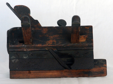
roughing plane, c. 1890 - 1950
Owned by the Mundy family of Orbost district. The Mundy family were farmers / settlers in the Snowy River area since c. 1880s. The original Mundy family moved to a land "selection" at Betebolong in the early 1880's from Buchan. Mundy familyA roughing plane made of wood with a small blade, held together with metal bolts. Also called a grooving plough plane.WHM is stamped into the wood (WJM?)grooving-plane roughing-plane woodworking-tool -
 Victorian Aboriginal Corporation for Languages
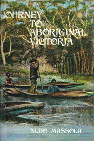
Book, Aldo Massola, Journey to Aboriginal Victoria, 1969
Looks at the Aboriginal community from the time of white contact, across many parts of Victoria. Chap.1; Melbourne - early missions, camp of Native Police, corroboree trees, canoe trees, grave &? headstone of Derrimut; quarries at Keilor, excavation sites at Green Gully &? Keilor; quarry at Mt. William, notes on inheritance of quarries Coranderrk settlement - Barraks grave, notes on his life; Chap.2; Geelong - Yawangi group of the Wothowurong tribe, camping grounds in area quarries; Notes on William Buckley, Gellibrand (a notable Aboriginal), graves in the Western Cemetery; Chap.3; Colac - war between Colac &? Geelong tribes; Mission at Birregurra, reason for failure of Buntingdale Mission; brass plate to Coc-coc-coine; reserve at Elliminyt, native ovens, camp sites, initiation site &? ritual; quarry sites, axegrinding factory, rock pecking &? engraving; dried hand &? 3 Aboriginal skulls found; Chap.4; The south-west coast - middens, camp sites notes on Framlingham Stn., fish traps at Tyrendarra; Chap.5; The far west - massacres of Aborigines near Casterton; camp sites, oven mounds; the first cricket team formed; Aboriginal cemetery; Chap.6; Hamilton - camps; Mount Rouse Station, axegrinding grooves at Nareeb Nareeb, shelters described, fish traps, massacre at Lake Condah; mission; canoes; Chap.7; Camperdown - legend about Lake Bullen Merri; obelisk erected in memory of Aborigines of district especially chief Wombeetch Puyuun; Jarcoort tribe; fish weirs, camps, intertribal fights between Booluc-burrers, Jarcoorts &? Ellengermote groups; bartering place at Mount Noorat; articles traded, legend of Flat-Top Hill; Chap.8; Ballarat - camp at Lake Wendouree; White Stone Lagoon; legends concerning Mt. Buninyong &? waterfalls at Lal-lal; camp sites; pygmy-type implements near Meredith, quarry at Glue Pot Rocks near Durdidwarrah; brass plate of King Billy; Chap.9; Ararat - Tjapwurong territory; camp sites, quarries, shield &? canoe trees; Bunyip belief at Lake Buninjon of Muk-jarawaint &? Pirtkopen-noot tribes, gives legend; stone implements; mill stones; fish weirs; stone arrangement near Lake Wongan; ground drawing of a bunyip, paintings in rock shelter near Mt. Langi Ghiran; Chap.10; Maryborough - camps, oven mounds, rock wells, stone arrangement at Carisbrook; camp sites at Mt. Franklin; Chap.11; Charlton - belief in Mindye (snake); canoe trees, ovens, camp sites, water holes, rock wells, stone implements; method of rainmaking; Chap.12; Horsham-Stawell, The Wimmera - Wotjobaluk land; camps, fish traps at Toolondo; Black Range cave paintings, Flat Rock shelters (detailed account of these paintings); Bunjils Cave; Chap.13; Horsham-Stawell, The Mallee - camp sites, implements; Ebenezer Mission, Willie Wimmera taken to England by Rev. Chase to become a missionary, died in England; Chap.14; The Murray River, Mildura Swan Hill - Battle of the Rufus; ceremonial ground, Lake Gol Gol, canoe &? shield trees; stone implements; camp sites, fire place arrangements; fish traps; oven mounds; Chap.15; The Murray River, Swan Hill-Echuca - legend about Lake Boga; camps, oven mounds, the Cohuna skull, Kow Swamp, method of burial; Chap.16; Shepparton ovens; brass plates of King Paddy of Kotupna &? King Tattambo of Mulka Stn., native well, camps; Chap.17; Wangaratta -camps, quarry, rock holes, the Faithful massacre; grinding rocks at Earlston; Chap.18; The High Plains - Ya-itma-thang; camps, Bogong moth feasts, native paths for trade &? intertribal fights, articles traded; painted shelters; Koetong Ck. Valley, near Mt. Pilot &? near Barwidgee Ck.; Chap.19; Dandenong - water holes, list of 8 holes in Beaumaris - Black Rock area; camps, middens, stone implements (microliths), legend of Angels Cave, stone axes, Native Police Force, Narre Narre Warren Station, legend about rocks on Bald Hill, kangaroo totemic site; Chap.20; Wonthaggi- Yarram - natives visit Phillip Is., murder of William Cook and Yankee by five Tasmanians (listed as Bon Small Boy, Jack Napoleon Timninaparewa, Fanny Waterpoordeyer, Matilda Nattopolenimma and Truganini) near Cape Patterson, men; camp sites, middens, legend of White Rock; Chap.21; Sale - Bairnsdale, The Lakes Country middens, camps; legend at Wulrunjeri; story of a white woman supposedly living with with the Tutangolung tribe, efforts made to prove story; canoe trees; Chap.22; Sale-Bairnsdale, The Inland Braiakolung tribe, camps, implements, canoe &? shield trees; Ramahyuck Mission, grinding rocks, fights with Omeo tribe; native tracks, death through enemy magic - procedure, belief in ghosts; Chap.23; Lakes Entrance and the Country to the east - Kroatungolung people, legend of Kalimna Valley; camps, stones of Nargun, bunyip, devils at Lake Tyers, excavation at Buchan, carbon dates; middens, ochre at Cape Conrad, stone fish-hook file at Thurra River; note on Bidwel tribe; Each chapter gives historical details, early contacts, relationships with settlers; Aboriginal place names and detailed description of sites and geographical features.b&w photographs, b&w illustrations, colour illustrationsgeelong, colac, hamilton, camperdown, ballarat, ararat, maryborough, charlton, horsham, stawell, murray river, shepparton, wangaratta, dandenong, wonthaggi, yarram, sale, bairnsdale, lakes entrance -
 Gippsland Art Gallery
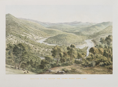
Print, Von Guerard, Eugene, Junction of the Buchan and Snowy Rivers (Gipps Land), c.1866-68
... Junction of the Buchan and Snowy Rivers (Gipps Land) Coloured ...Purchased with the assistance of the Caltex Victorian Government Art Fund, 1982Coloured lithograph on papergippsland, artwork, permanent collection -
 Orbost & District Historical Society
book, Key to the System of Victorian Plants, 1887 - 1888
Ferdinand von Mueller was born at Rostock, Germany, on 30 June 1825 , died at Melbourne, Australia, on 10 October 1896. He studied pharmacy and took his Doctor of Philosophy at the University of Kiel in 1847. He came to Australia in 1848 for health reasons and became a great botanical collector and writer. He was Victorian Government Botanist from 1853, and for a time Director of the Botanic Gardens. He travelled widely in Victoria and was on the A.C.Gregory expedition to northern Australia in 1855-57. He supported botanical exploration and collecting throughout the colonies. Charles Henry [Carl] Grove died on 17/4/1938 at Box Hill at the age of 88 and was buried in Orbost. Prior to coming to the Snowy River district, Carl worked as overseer on Buchan Station. In 1880, he selected land at Newmerella after first coming here in 1874 with early selector James A Robertson. He married Annie Robertson in 1876. Carl was a farmer, hop and seed grower and nurseryman. He was an elected Councillor of the newly formed Tambo Shire in 1882, and then in 1892 to the Orbost Shire where he served for many years filling varioius public roles. In 1911, he shifted to Queensland, but later returned to Victoria and died at Box Hill. (Ref. Nov 2014 Newsletter) Mueller was one of the first people to take a scientific interest in Victorian forests, and argued against indiscriminate clearing of land. This item is a useful research tool. It is associated with Carl Grove, a prominent early resident of Orbost.A black book with the title "Key To The System of Victorian Plants 1" in gold print.inside cover - "To Carl Grove from Baron Von Mueller March 1896"von-mueller-ferdinand botany-victoria plants-victoria grove-carl -
 Orbost & District Historical Society
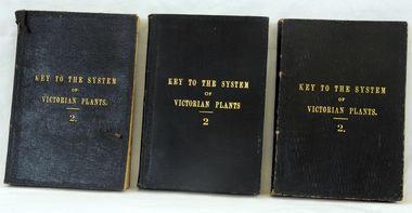
books, Robt. S. Bain, Key to the System of Victorian Plants 2, 1885
Ferdinand von Mueller was born at Rostock, Germany, on 30 June 1825 , died at Melbourne, Australia, on 10 October 1896. He studied pharmacy and took his Doctor of Philosophy at the University of Kiel in 1847. He came to Australia in 1848 for health reasons and became a great botanical collector and writer. He was Victorian Government Botanist from 1853, and for a time Director of the Botanic Gardens. He travelled widely in Victoria and was on the A.C.Gregory expedition to northern Australia in 1855-57. He supported botanical exploration and collecting throughout the colonies. 681.3 was presented to Carl Grove from G. Tadgell of Flemington. Charles Henry [Carl] Grove died on 17/4/1938 at Box Hill at the age of 88 and was buried in Orbost. Prior to coming to the Snowy River district, Carl worked as overseer on Buchan Station. In 1880, he selected land at Newmerella after first coming here in 1874 with early selector James A Robertson.He was one of the first selectors at Orbost - in 1880 he selected 320 acres at Newmerella, which he called „Ulinda‟ He married Annie Robertson in 1876. Carl was a farmer, hop and seed grower and nurseryman. He was an elected Councillor of the newly formed Tambo Shire in 1882, and then in 1892 to the Orbost Shire where he served for many years filling varioius public roles. In 1911, he shifted to Queensland, but later returned to Victoria and died at Box Hill. (Ref. Nov 2014 Newsletter) Mueller was one of the first people to take a scientific interest in Victorian forests, and argued against indiscriminate clearing of land. This item is a useful research tool. It is associated with Carl Grove, a prominent early resident of Orbost.Three copies of fabric bound book with a deep blue cover and the title, "Key To The System Of Victorian plants" in gold print. It has an ornate border around the edge.inside cover of 681.1 - To H. Grove, March 1891 Ulinda, Newmerella, Victoriaferdinand-von-mueller grove-carl botany plants-victoria -
 Orbost & District Historical Society
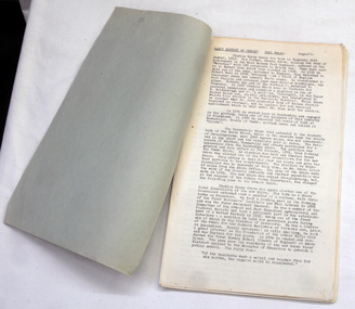
book, Grove, Carl, BUKAN MUNGEE
C.H. Grove spent about 40 years in the area, information is mainly derived from his own recollections and "reliable sources". Charles Henry [Carl] Grove died on 17/4/1938 at Box Hill at the age of 88 and was buried in Orbost. Prior to coming to the Snowy River district, Carl worked as overseer on Buchan Station. In 1880, he selected land at Newmerella after first coming here in 1874 with early selector James A Robertson.He was one of the first selectors at Orbost - in 1880 he selected 320 acres at Newmerella, which he called „Ulinda‟ He married Annie Robertson in 1876. Carl was a farmer, hop and seed grower and nurseryman. He was an elected Councillor of the newly formed Tambo Shire in 1882, and then in 1892 to the Orbost Shire where he served for many years filling varioius public roles. In 1911, he shifted to Queensland, but later returned to Victoria and died at Box Hill. (Ref. Nov 2014 Newsletter) This is a useful reference tool.A carbon copy of a typeset manuscript / transcript book entitled "Bukan Mungee" containing historical and geographical information of the area "bounded by the Snowy River in the east, the Tambo river in the west...and with the following leaseholds, Ensay, Gillingall, and Gelantipy on the north, with Kilmore and Corringle stations on the south..."grove-carl bukan-mungee corringle newmerella snowy-river tambo-river -
 Orbost & District Historical Society
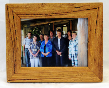
framed photograph, 14.4.2004
... the junction of the Buchan and Snowy Rivers. The Slab Hut is an Orbost ...This photograph was taken on 14.4.2004 at the time of the visit to Orbost by the Governor of Victoria, John Landy.The Orbost Visitor Information Centre is situated in Forest Park on Nicholson Street. The centre is housed in the historic Slab Hut. The hut was an original family dwelling built in 1872, on a site approximately three kilometres upstream from the junction of the Buchan and Snowy Rivers. The Slab Hut is an Orbost Icon. It supports one part time manager and a team of dedicated volunteers.A coloured photograph in a wooden frame. A group of people stand in front of the Slab Hut (Orbost Information Centre) .On frame - NATURAL FEATURED HARDWOOD MADE BY 20.12.98 W. ASHLYN MARLO VIC.slab-hut-committee photograph -
 Orbost & District Historical Society
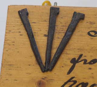
nails on board, 1885
These nails were made for Walter John Mundy (1868-1944). Often imported nails made for the softer English and North American timbers bent when hammered against the harder colonial woods and so The Mundy family were farmers / settlers in the Snowy River area since c. 1880s. The original Mundy family moved to a land "selection" at Betebolong in the early 1880's from Buchan. It's only over the past century or so that the mass-produced nail has become an inexpensive and common way to join materials. These three iron nails were hand made by an early Orbost settler or blacksmith in the 1880's, using iron, forge and anvil. They are examples of the types of nails used in the 19th century. A rectangular, wooden(athel pine?) board with three hand-made nails glued in fan design to top left corner of section of floorboard. There is a short length of yellow cord attached for hanging. To the right of the nails is hand-written text in black. the nails have irregular shanks and hammer marks on both shanks and heads.right of nails - " Flooring & nails from Walter Mundy's house at Jarrahmond built C.1885. Still in use to this day."mundy-walter hand-made-nails -
 Orbost & District Historical Society
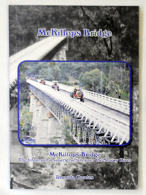
book, McKillops Bridge, 2014
This book was purchased new by Orbost & District Historical Society. Written by Buchan historian, Rhonda Coates, the book was commissioned by Tubbut Neighbourhood House following a commemoration event in 2002 when many people gathered for a special day organised by Sister Helen Barnes and the Tubbut community. (ref. Bombala Times)This book is a useful research item.A paper back book, titled McKillops Bridge, written by Rhonda Coates. On the front cover is a photograph tractors crossing the bridge during the Great Snowy River Tractor Stampede ( The Snowy River Tractor Strampede, a 560-kilometre journey, is organised by the Bega and District Historical Machinery Club every January - the first being held in 2009.) this photograph is inset over an earlier phpotograph by Howard Bulmer c 1936. The book contains the history of the bridge, photographs of the bridge and times before its construction.On front fly-Orbost &District Historical Society Incmckillops-bridge -
 Orbost & District Historical Society
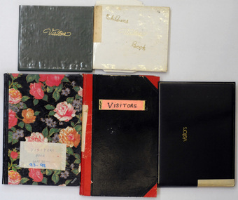
visitor books, 1987 -1989
... on a site about 3 km upstream from the junction of the Buchan ...These books were used at the Slab Hut (Orbost Visitor Information Centre) as visitor sign in books. Orbost. This slab hut was built in 1872 as a family dwelling on a site about 3 km upstream from the junction of the Buchan and Snowy Rivers about 40 kms from Orbost on the Yalmy Rd. No nails were used in the construction; it was all wired together. After a period in storage the slab hut was opened in its present location in Orbost as the Information Centre in 1987. The Slab Hut is an Orbost icon.Five books used by the Slab Hut (Orbost Visitor Information Centre) as visitor sign in books. 2467.1 has a green cover with "Visitors" in gold print and is dated 28.3.87 - 6.7.87. 2467.2 has a black cover with a gold border and "Visitors" in gold print. It is dated 11.6.87 - 3.11.89. 2467.3 has a black cover with red corners and spine. 2467.4 has pink and red flowers on a black background and is dated Sept 93 - 9.3.98. 2467.5 is a Children's Visitor Book and has a white cover with gold print. It is dated 9.4.87 -23.7.89. All contain handwritten comments, details of visitors to the Orbost Visitor Information Centre.2467.1 - Inside front cover - OFFICIALLY OPENED 28.3.1987 by VIC. GOVERNOR DAVIS McCAUGHEY 2467.2 - label on spine - VISITOR BOOK 2 inside a circle. 2467.3 - label on front - VISITORS ; label on spine - dates Feb 89 - Sep 93 2467.4 - label on front - VISITOR'S BOOK Sept 93 -9.3.98 tourissm slab-hut orbost-visitor-information-centre -
 Orbost & District Historical Society
documents in folder, 1988 -1992
... of the Buchan and Snowy Rivers about 40 kms from Orbost on the Yalmy Rd ...These folders contain letters written to the Slab Hut either requesting information or making comments. There are copies of the replies.The Slab Hut (Orbost Visitor Information Centre) is an Orbost icon. This slab hut was built in 1872 as a family dwelling on a site about 3 km upstream from the junction of the Buchan and Snowy Rivers about 40 kms from Orbost on the Yalmy Rd. No nails were used in the construction; it was all wired together. After a period in storage the slab hut was opened in its present location in Orbost as the Information Centre in 1987.Two manila folders containing correspondence to/from Orbost Visitor Information Centre. The letters are tied together with string/ribbon. Most are information requests with copies of the replies.correspondence-orbost-visitor-information-centre tourism -
 Orbost & District Historical Society
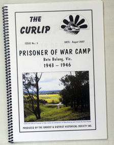
book, The Curlip - P.O.W.Camp Bete Bolong, Vic. 1943-1946, August 2007
This is Issue No. 5 of "The Curlip". The magazine is a compilation of research from a trip by the Orbost & District Historical Society to Bete Bolong. The Bete Bolong Prisoner of War Camp was located on the south side of the Buchan - Orbost Rd. From November 1943 to November 1945, Italian prisoners of war were based at Bete Bolong, cultivating maize, peas, beans and other vegetables on local farms. Unlike other 'farming' prisoners of war, those at Bete Bolong did not live with the farming families, but at a Prisoner of War Control Centre on Crown land overlooking the Snowy River Flats. About fifty Italian prisoners lived at the centre, along with an Australian Military Force staff of approximately seven people. The prisoners were driven to and from the farms each day. Three of them apparently simply swam across the river to work. They worked a six day week, with Sundays off. Although they were provided with rations, both prisoners and staff maintained vegetable and flower gardens. They were also skilled at cooking 'anything' they could catch, and at making illegal "grappa". Very few of the Italians were experienced farm workers. Some of them used their skills to make things for the families they worked for; a cabinet-maker made furniture , a cobbler made shoes, etc. They interacted with the local community and, although they were not supposed to go within one kilometre of town, some were found at local dances on Saturday nights. As recreation the prisoners were allowed to walk along the road to the west of the camp. Local people from both sides of the river could hear them sing as they walked. The prisoners also helped to construct an 'ant bed' tennis court on a property adjacent to the centre. Although now overgrown, the site of the tennis court can still be discerned as a flat area above the site of the centre. (ref./vhd.heritagecouncil.vic.gov.au)This item is a useful reference tool on the history of the Prisoner of War Camp at Bete Bolong, Orbost.A spiral bound book with a clear plastic cover. On the front is a coloured photograph of a view from the site of the P.O.W. camp at the intersection of Bete Bolong and Buchan Roads at Bete Bolong. Above is the title "Prisoner of War Camp Bete Bolong, Vic. 1943-1946" in black print on a white background. p.o.w.-camp-orbost ww11 bete-bolong -
 Orbost & District Historical Society
document, Grove, Carl, June 18 1910
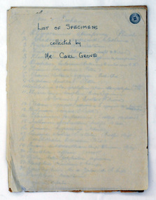
Charles Henry [Carl] Grove died on 17/4/1938 at Box Hill at the age of 88 and was buried in Orbost. Prior to coming to the Snowy River district, Carl worked as overseer on Buchan Station. In 1880, he selected land at Newmerella after first coming here in 1874 with early selector James A Robertson. He married Annie Robertson in 1876. Carl was a farmer, hop and seed grower and nurseryman. He was an elected Councillor of the newly formed Tambo Shire in 1882, and then in 1892 to the Orbost Shire where he served for many years filling varioius public roles. In 1911, he shifted to Queensland, but later returned to Victoria and died at Box Hill. (Ref. Nov 2014 Newsletter) Carl Grove was a prominent Orbost early settler. This document is a useful research tool.A document hand-written on foolscap sized paper. There is a "List of Species Collected by Mr Carl Grove" and a letter written by Carl Grove to the president and committee of the Mechanics Institute Orbost.document-species-list-orbost grove-carl -
 Orbost & District Historical Society
ruler, C 1930's
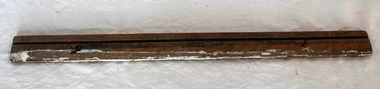
The Mundy family were farmers / settlers in the Snowy River area since c. 1880s. The original Mundy family moved to a land "selection" at Betebolong in the early 1880's from Buchan. John Mundy grew up in the Orbost district. This item highlights the comparison between today's educational equipment and those of the 1930's.A 15 inch wooden ruler with carvings and holes.On back - J. MUNDYmeasurement ruler mundy-family educational -
 Orbost & District Historical Society
coloured photograph
There is no information with this item. "The Pyramids", was named due to huge rocks that jut out from the hill, being shaped similarly to the Egyptian Pyramids. " Where the Murrindal River winds between high limestone bluffs before disappearing into a mountainside and becoming an underground river, four miles north-east of Buchan, is the region known as The Pyramids. It is an area of limestone caverns and sink holes overshadowed by three rock stacks. Some of the caves are the last resting places of long dead Murrindal animals." ( from MBW Walk magazine 1970 - Melbourne Bushwalkers"A hand-painted colour photograph of a view of mountain ranges with men on horses in the background.on front - "Pyramid Gorge Buchan"pyramid-gorge-buchan murrindal limestone-caves -
 Orbost & District Historical Society
black and white photograph, late 19th / early 20th century
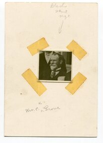
This is a photograph of Councillor Charles Henry Grove who represented South Riding on the Orbost Shire Council. from 1893 - 1901. He was president in 1893-1894, 1895-1896 and 1900-1901. He also served on the Tambo Shire prior to the formation of the Croajingolong / Orbost Shire. Charles Henry [Carl] Grove died on 17/4/1938 at Box Hill at the age of 88 and was buried in Orbost. Prior to coming to the Snowy River district, Carl worked as overseer on Buchan Station. In 1880, he selected land at Newmerella after first coming here in 1874 with early selector James A Robertson. He married Annie Robertson in 1876. Carl was a farmer, hop and seed grower and nurseryman. He was an elected Councillor of the newly formed Tambo Shire in 1882, and then in 1892 to the Orbost Shire where he served for many years filling various public roles. In 1911, he shifted to Queensland, but later returned to Victoria and died at Box Hill. (info. Newsletter 113)This item is associated with the Orbost Shire Council. The shire covered an area of 9,347 square kilometres and existed from 1892 until 1994 when it became part of the East Gippsland Shire Council. It is associated with Carl Grove, a prominent early Orbost citizen.A black / white head and shoulders portrait photograph of a bearded man in a suit. There is also a framed copy.grove-charles-henry grove-carl orbost-shire-council -
 Orbost & District Historical Society
black and white photograph, early 20th century
This is a photograph of Councillor Charles Henry Grove who represented South Riding on the Orbost Shire Council. from 1893 - 1901. He was president in 1893-1894, 1895-1896 and 1900-1901. He also served on the Tambo Shire prior to the formation of the Croajingolong / Orbost Shire. Charles Henry [Carl] Grove died on 17/4/1938 at Box Hill at the age of 88 and was buried in Orbost. Prior to coming to the Snowy River district, Carl worked as overseer on Buchan Station. In 1880, he selected land at Newmerella after first coming here in 1874 with early selector James A Robertson. He married Annie Robertson in 1876. Carl was a farmer, hop and seed grower and nurseryman. He was an elected Councillor of the newly formed Tambo Shire in 1882, and then in 1892 to the Orbost Shire where he served for many years filling various public roles. In 1911, he shifted to Queensland, but later returned to Victoria and died at Box Hill. (info. Newsletter 113Carl Grove was a prominent early Orbost citizen.A small square head and shoulders photograph of a man. It is attached to a white card with tape.on front - "Mr C. Grove"grove-charles -
 Orbost & District Historical Society
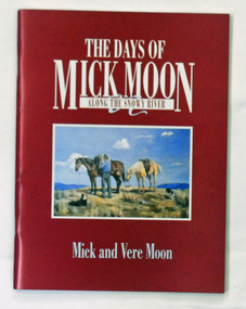
book, The Days of Mick Moon - along the Snowy River, 1988
... Snowy-River Moon-Mick Buchan... Moon. Snowy-River Moon-Mick Buchan James Yeates & Sons P/L ...A 47 pp book containing anecdotes of frontier life around Buchan, stories and line drawings. It has a dark red cover with the title in white print. In a frame is a painting of a stockman adjusting the saddle on a brown horse with white horse standing next to it. There are two black and white dogs lying nearby. The setting is the alpine region of Victoria. the book was authored by Mick and Vere Moon.snowy-river moon-mick buchan